About "A Vision for American Empire":
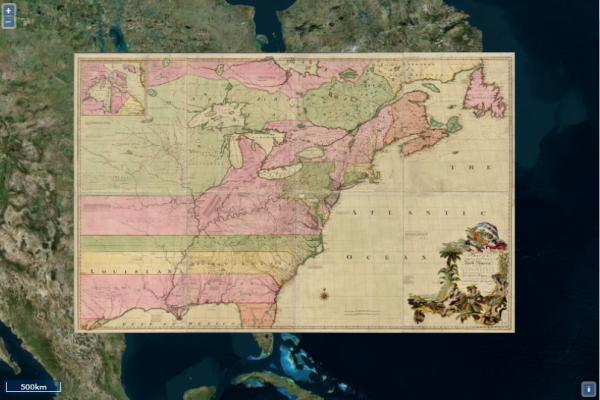
Maps for S. Max Edelson, The New Map of Empire: How Britain Imagined America before Independence (Harvard University Press, 2017)
About The New Map of Empire: How Britain Imagined America before Independence:
His current research focuses on the geography and cartography of North America and the Caribbean. Victories in the Seven Years’ War yielded territorial acquisitions that extended British America west to the Mississippi, north into Canada, and south to the Florida Keys and the Windward Islands. To better understand, settle, and defend this new empire, teams of surveyors fanned out across the continent and into the Caribbean Sea to map places as diverse as frigid Nova Scotia and the tropical island of Grenada. Their quest to integrate British America on the eve of the American Revolution is the subject of his current research. The New Map of Empire: How Britain Imagined America before Independence (Harvard University Press, 2017) features a dynamic digital archive of the original maps and charts discussed in the book.