From the website:
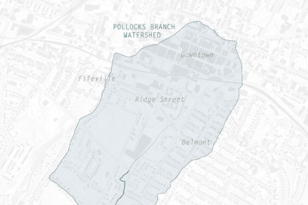
Reinterpreting the Pollock's Branch Watershed is an interdisciplinary mapping project undertaken by the University of Virginia's Center for Cultural Landscapes and led by faculty in the Department of Drama and the School of Architecture. It focuses on the Pollock's Branch Creek watershed that runs south of Garrett Street downtown to Moore's Creek and from Avon Street to Ridge Street. This diverse area, falling partly within the City of Charlottesville’s Strategic Investment Area, comprises much of the IX property as well as several public housing properties and portions of the Belmont and Ridge Street neighborhoods.
Through the joint methods of dance and landscape architecture, the project elicits the engagement and participation of community members in a collective process designed to:
Identify and celebrate the unique features and places valued by the local community
Reimagine the area's future use and character as the City continues to change over time
Create a place-based experience of the watershed to share with the larger Charlottesville community
This project is funded in part by a UVA Faculty Research Grant for the Arts and through funding made available from the UVA Center for Cultural Landscapes, the Department of Drama, and the School of Architecture. Technical geospatial support was provided by the UVA Scholars’ Lab.